
WIND.MAP
In 2012, Point.B Studio held an art exhibit entitled {~beaux libre*} which culminated in a series of limited edition art prints with origins in Internet art initiatives. The exquisite “wind map” by Martin Wattenberg and Fernanda Viégas remains a distinct highlight of the show. The wind map is an interactive art visualization that depicts surface wind data across the United States daily on the web at http://hint.fm/wind/.
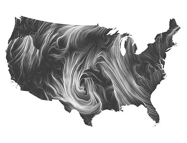
Hurricane Sandy hit the East Coast not long after the exhibit opened which resulted in a special edition of wind map with prints highlighting the epic storm. The two artists, Wattenberg and Viégas, captured data in Boston as the storm was in progress and sent the visualizations across the Internet to Point.B in Oregon while the show was in progress for imaging.
New editions of wind map are created at the discretion of the artists or as previous editions sell out. Below is a list of our latest limited print editions — http://sixes.net/point.b/windmap.html.
- More at Wired Magazine.
- Wind Map at MOMA